
Walking a Pasadena Street Trail
The most reliable Pasadena street directory workflow moves from an address to named record roles, not from a street name to a supposed household list. HCAD begins the address side. The County Clerk provides the recorded-instrument side. Voter results can add limited civic context, and an older criss-cross or address-arranged directory can add a dated historical snapshot. No public Pasadena source provides a complete current street roster.
- Address to parcel. Normalize the number, directional prefix, street name, suffix, unit, and ZIP. Run HCAD’s exact address search, then its range search if a first search fails.
- Parcel to owner display. Record the tax year, account, situs, mailing field, legal description, property type, and owner display. Do not call the owner an occupant from this step alone.
- Owner to deed. Search the County Clerk index with the legal description, current grantee, date, and instrument fields. Keep grantor, grantee, trustee, file number, and recording date as separate roles.
- Deed to voter context. When a narrow civic check is appropriate, use the Harris voter lookup for its visible status and precinct fields. Protected addresses and withheld fields remain protected.
- Voter to criss-cross evidence. For a past date, test the library’s city-directory edition or its address index if the edition has one. Label it as a historical listing, not proof of a present occupant.
Pasadena Street HCAD Searches
HCAD Quick Search is a public appraisal portal with account, address, and owner-name tabs. For a Pasadena street directory search, use the address tab first. HCAD says capitalization is not material, but its local street format matters: use N, S, E, or W instead of a spelled-out direction, omit periods, and try the Zeros control for a zero or unknown number. A record can also be missing because the entered address is a mailing address, the parcel is not yet mapped, or appraisal and GIS timing differ.
| Search path | Verified field set |
|---|---|
| Account | Tax Year; 13-Digit Account Number; Search. |
| Exact address | Tax Year; Street No.; Street Name; Similar Street Name; Search. |
| Address range | Tax Year; beginning and thru street numbers; Street Name; Street No. Zeros; Search. |
| Owner name | Tax Year; Last Name; First Initial; no comma; Search. |
| Advanced real property | Verified five-digit ZIP Code field; review live address, account, owner, and property-type controls before relying on a changed interface. |
HCAD’s Advanced Real Property search has a verified ZIP Code field in addition to the Quick Search address tools.
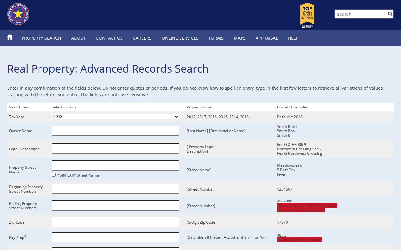
Use a ZIP as a narrowing field only. Pasadena postal areas cross municipal and parcel boundaries, so the returned situs and legal description still need review.
Pasadena Street Address Labels
A Pasadena address can carry four different meanings. The situs address is the physical property location on the appraisal record. A mailing address receives a tax notice and can be elsewhere. An owner display names an appraisal or recorded-property party, which might be an entity, trust, estate, lender, or person. An occupant is someone independently shown at the place and date by a source built to record that fact. These labels cannot be substituted for one another.
HCAD itself cautions that appraisal data is not an abstract or title record. Homestead information is narrow appraisal evidence and is not a complete people list. County Clerk instruments may rely on a subdivision, lot, block, or unit instead of a current street address. Voter and directory addresses have their own date and purpose. This distinction is the core limit of a street directory search.
Pasadena Street Parcel Geometry
The official HCAD Parcels MapServer provides a parcel-boundary layer. Its parcel polygon is a property boundary, not a people record. The service describes spatial reference 102740 in feet, supports JSON and GeoJSON output, and has a maximum record count of 1,000. Use it after an HCAD account search to compare nearby parcels, city labels, and subdivision context along a Pasadena street.
The HCAD parcel map service is the verified official GIS access point for parcel-boundary metadata.
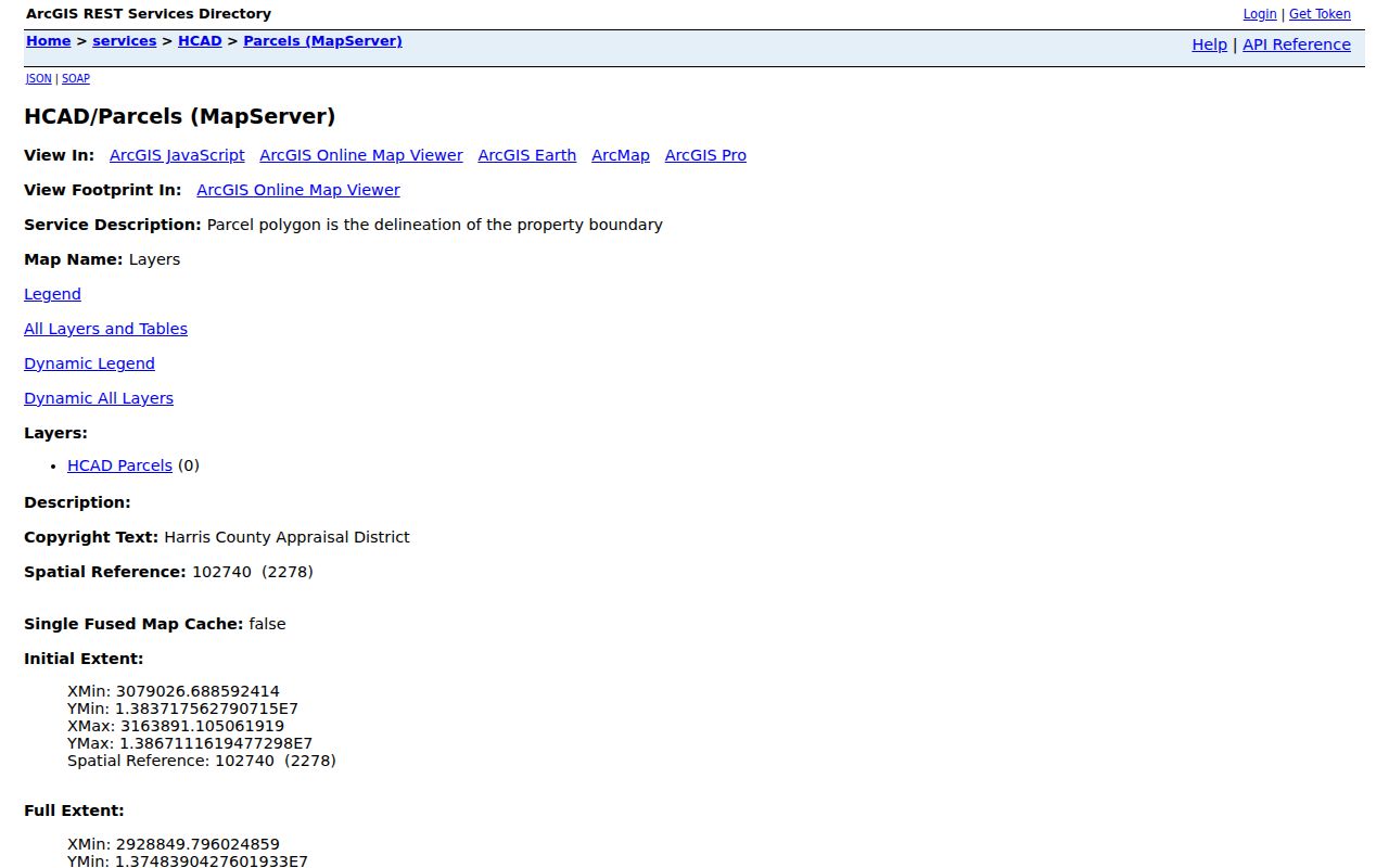
Parcel outlines can clarify where one lot ends and the next begins. They cannot prove a shared household, relationship, or current street resident.
Pasadena Street GIS Queries
The HCAD Parcels FeatureServer query offers Where, object-ID, input-geometry, geometry-type, spatial-relationship, distance, units, out-fields, return-geometry, output spatial-reference, count, extent, order, offset, and output-format controls. An intersects or nearby query can generate an adjacent-parcel set once the target parcel geometry is known. Save the query relationship, result count, and fields returned with any Pasadena street-directory note.
The official FeatureServer query interface shows the spatial and output controls used for adjacent-parcel research.
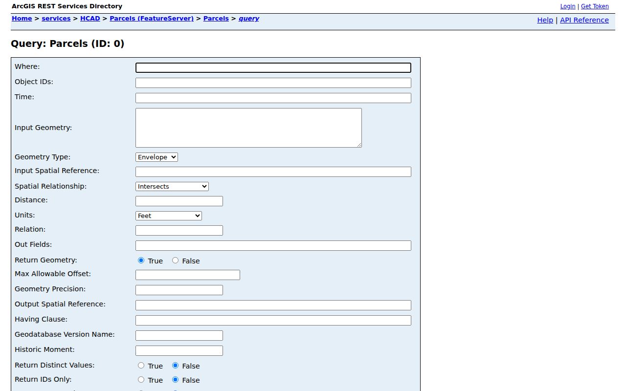
Use returned object IDs and parcel attributes as a map-work worksheet, then check HCAD and County Clerk records for their different address and party fields.
Pasadena Address Record Sources
Address-keyed records cover a street in pieces. The table distinguishes the custodian and the meaning of each result. A parcel number is a useful bridge among sources, but it does not convert all of them into a complete address roster.
| Record set | Keeper | What it shows | Access |
|---|---|---|---|
| Appraisal parcel card | HCAD | Tax year, account, situs and mailing fields, owner display, legal description, value, exemptions, jurisdiction, neighborhood | Quick or Advanced Search; nightly-refresh caveat |
| Parcel geometry | HCAD GIS | Polygon boundary, object ID, returned attributes, city or subdivision layers, spatial relationships | Public REST MapServer and FeatureServer query |
| Recorded instrument | Harris County Clerk | Grantor, grantee, trustee, dates, instrument type, legal description, volume, page, file, image status | Public index; images from 11/1/1960, account, fees, and redactions |
| Permit or site plan | Pasadena Planning and Permit | Applicant, representative, owner, project, property address, HCAD account, structure information | PDF or CSS account route; project record only |
| Voter record | Harris voter registrar | Status, public VUID where shown, precinct and polling context | Current or pending lookup; sensitive fields excluded |
| Historical directory or census | Library or NARA | Dated person, address, household, or occupation snapshot | Edition, year, page, or enumeration citation required |
HCAD, the deed index, permits, voter registration, and a library directory are best read together only after their dates and field labels line up. The shared street name is a search key, not a conclusion.
Pasadena Street Deed Chain
The Harris County Clerk Real Property index supports a legal-description-first method when an address has changed or does not appear on an instrument. Search by subdivision or description, grantor, grantee, trustee, date, instrument type, volume, page, section, lot, block, unit, abstract, outlot, tract, or reserve. Start with the HCAD legal description and current grantee, then locate the latest deed and use the prior grantor and the same parcel description to move backward.
Images start November 1, 1960, according to the portal. A registered account is needed for unofficial watermarked images. The County Clerk lists a $5 search charge unless a file number or film code is supplied, and separate copy and certification charges can apply. For older deeds, the Texas State Library and Archives Commission has direct and reverse Harris County indexes and deed reels from 1837 through 1886. Harris County Archives is an appointment fallback for historical material.
Pasadena Street Permit Context
Pasadena planning and permit materials can tie a project to an address without naming a resident. The city’s site-plan form includes applicant, authorized representative, owner, project title or business name, property address, HCAD account, proposed or current use, structure size, estimated cost, acreage, and permit details. If no address exists, the form directs the applicant to the Permit Department. The CSS portal, launched April 28, 2026, supports uploads, invoices, status tracking, and comments for listed application types.
Engineering maintains maps, GIS, elevation certificates, and utility-availability information. Pasadena floodplain records include elevation certificates for buildings built in a floodplain since the early 1980s, with the Permit Department identified as the holder. These can date a structure or explain its setting. An applicant, owner, representative, or project contact is a project role, not proof of who lives there.
Pasadena Street Postal Checks
Pasadena’s verified postal ZIP set runs from 77501 through 77508, but a ZIP is delivery geography rather than a municipal boundary. The USPS full-address lookup supplies the current delivery city and ZIP. HCAD’s Advanced Search has a five-digit ZIP field, while the citywide district map shows city limits, precincts, bayous, industrial areas, and districts. Compare all three for a specific street. Do not infer city residence from a postal label alone.
Pasadena is non-zoned while land-development rules still apply, and extraterritorial industrial districts are outside city ordinance and permit coverage. That makes the municipal or ETJ distinction important when a permit result is found near a Pasadena address. An older legal description may also predate the modern street name. Search by lot, block, subdivision, or grantor and grantee before treating a street-only search as complete.
Pasadena Street Record Terms
A few short definitions keep a street-by-street note accurate when it crosses the appraisal, GIS, deed, and directory systems.
- Parcel
- A mapped property unit with a boundary and appraisal account. It does not identify a household.
- Situs address
- The physical address on an appraisal record, distinct from a mailing address.
- Plat
- A recorded subdivision map that can help connect lots, blocks, and street layout.
- Criss-cross directory
- An address-arranged directory when a particular edition includes that format.
- Legal description
- The subdivision, lot, block, unit, or other recorded parcel description used to locate an instrument.
Pasadena Street History Fallbacks
Older Pasadena street research needs more than a modern portal. The library can search historic Pasadena city directories and confirms a 1948 through 1951 example, with historic directories available inside the library through Ancestry Library Edition. Whether an edition contains a reverse index must be checked at the workstation. A dated directory entry can show a subscriber or household snapshot, but it needs an edition and page citation.
For pre-modern deeds, use TSLAC direct and reverse indexes, reels, probate, and tax material, or make an Archives appointment. Federal census records through 1950 can supply an enumeration-date snapshot. The research did not locate a verified Pasadena street-renumbering schedule or a citywide historical-address crosswalk. Preserve old street spellings and legal descriptions instead of inventing a modern match. The historical collection details are available through the Pasadena Directory Book.
Pasadena Street Privacy Limits
Public address records contain deliberate gaps. Voter web results withhold telephone, Social Security, driver-license, personal-ID, and date-of-birth fields, and eligible protected addresses can display as ***. HCAD’s online owner-display replacement route has a narrow web-only scope. Utilities, school attendance zones, and private organization member rosters are not a public street directory. An empty result can reflect protection, role, timing, or a non-digitized record.
Keep the custodian, source date, exact query form, and field meaning with every note. That small record of method is often more useful than a long list of names, and it respects the limits built into each Pasadena street source.