
Pasadena Postal Coverage
The official USPS Postal Bulletin and the Texas General Property Code list identify eight Pasadena postal areas: 77501 through 77508. The evidence supports that set, not a street-by-street neighborhood assignment or a municipal-boundary crosswalk. USPS decides the result for the full delivery address. The research did not locate a verified post-office station assignment or granular area table for each row, so the table leaves those claims unmade.
| ZIP | Areas Covered | Post Office | Notes |
|---|---|---|---|
| 77501 | Pasadena postal area | No station assignment verified | Use USPS for the exact address; it is not city-limit proof |
| 77502 | Pasadena postal area | No station assignment verified | Healthy Parks material reports survey concentration, not a boundary or population count |
| 77503 | Pasadena postal area | No station assignment verified | Confirm delivery address and municipal jurisdiction separately |
| 77504 | Pasadena postal area | No station assignment verified | A postal city label can cross city or nearby jurisdiction lines |
| 77505 | Pasadena postal area | No station assignment verified | Civic groups may use it; the code alone does not establish city limits |
| 77506 | Pasadena postal area | No station assignment verified | Pasadena City Hall uses this code, which does not define a citywide boundary |
| 77507 | Pasadena postal area | No station assignment verified | Regional maps give industrial and southern-area context; verify the parcel |
| 77508 | Pasadena postal area | No station assignment verified | Check the full address with USPS and municipal or county mapping |
That is the useful scope of a Pasadena ZIP code directory: a verified postal starting point. It is more honest than attaching unverified neighborhood names, station labels, or a complete city-limit claim to every code. One postal code can also be associated with more than one postal place name.
Pasadena ZIP Code Workflow
For a specific Pasadena address, work from the delivery record outward. The order below prevents a postal result from silently becoming a property, municipal, or person claim. It also produces a repeatable note if another source later uses a different address spelling or a historical postal convention.
- Enter the full current street address in the USPS ZIP Lookup and record the returned postal city and code with the date checked.
- Search the same address in HCAD Quick Search and preserve tax year, account, situs, legal description, and any mailing-address distinction.
- Compare the parcel to Pasadena city-limit, district, road, and flood information through Pasadena Engineering or the city district map.
- Use the voter route only for its civic purpose, keeping precinct and registration status distinct from an occupancy conclusion.
- Add a Neighborhood Network label only as organization geography, then note whether postal, parcel, precinct, and municipal results agree.
A ZIP-only name search is weak because it can pull a mailing address, a postal alias, or a parcel beyond city limits. Once a code has narrowed a question to a street, the Pasadena street directory has the address-record chain for parcel and deed work.
Pasadena Delivery Geography
USPS delivery geography and Pasadena municipal geography are separate systems. A postal city label is used for delivery, while a city limit comes from municipal and parcel mapping. The Healthy Parks Plan includes Pasadena alongside nearby and overlapping codes such as 77017, 77536, 77571, 77587, 77034, 77059, 77062, 77558, 77573, and 77586. That planning map is context, not a complete municipal ZIP crosswalk.
PO boxes, mailing addresses, and city-name aliases can return a different code from a parcel's situs. A situs is the physical property location in the appraisal record. A mailing address is where a tax notice goes. Neither by itself tells the reader which municipality owns a record or whether a particular person is currently at that address.
- ZIP
- A Postal Service delivery code that must be checked against a full address.
- ZIP+4
- An added delivery segment for a narrower address range, not a municipal identifier.
- PO-box ZIP
- A code tied to a post-office box delivery arrangement, which can differ from the property situs.
- Carrier route
- A delivery-routing grouping that does not establish a neighborhood boundary or a household list.
Pasadena HCAD ZIP Field
HCAD Advanced Search has a verified five-digit ZIP Code field, illustrated with 77070 in the live help material. Test 77501 through 77508 one at a time, then inspect the returned situs and municipality. HCAD warns that postal-area records can extend outside the municipal limit, so the field is a parcel lead rather than a confirmed Pasadena-resident list.
| HCAD search element | Verified use | Research note |
|---|---|---|
| ZIP Code | Five-digit input | Test one Pasadena postal code at a time and compare returned situs data |
| Address or account | Use to inspect an individual parcel after filtering | Keep account, tax year, situs, and legal description together |
| Municipality comparison | Review returned parcel information with city mapping | A postal match can include nearby jurisdiction records |
The HCAD search-help source below explains useful address troubleshooting. It also notes that an address may fail because it is a mailing address, has a zero or unknown street number, is not mapped, or is caught in an appraisal and GIS timing gap.
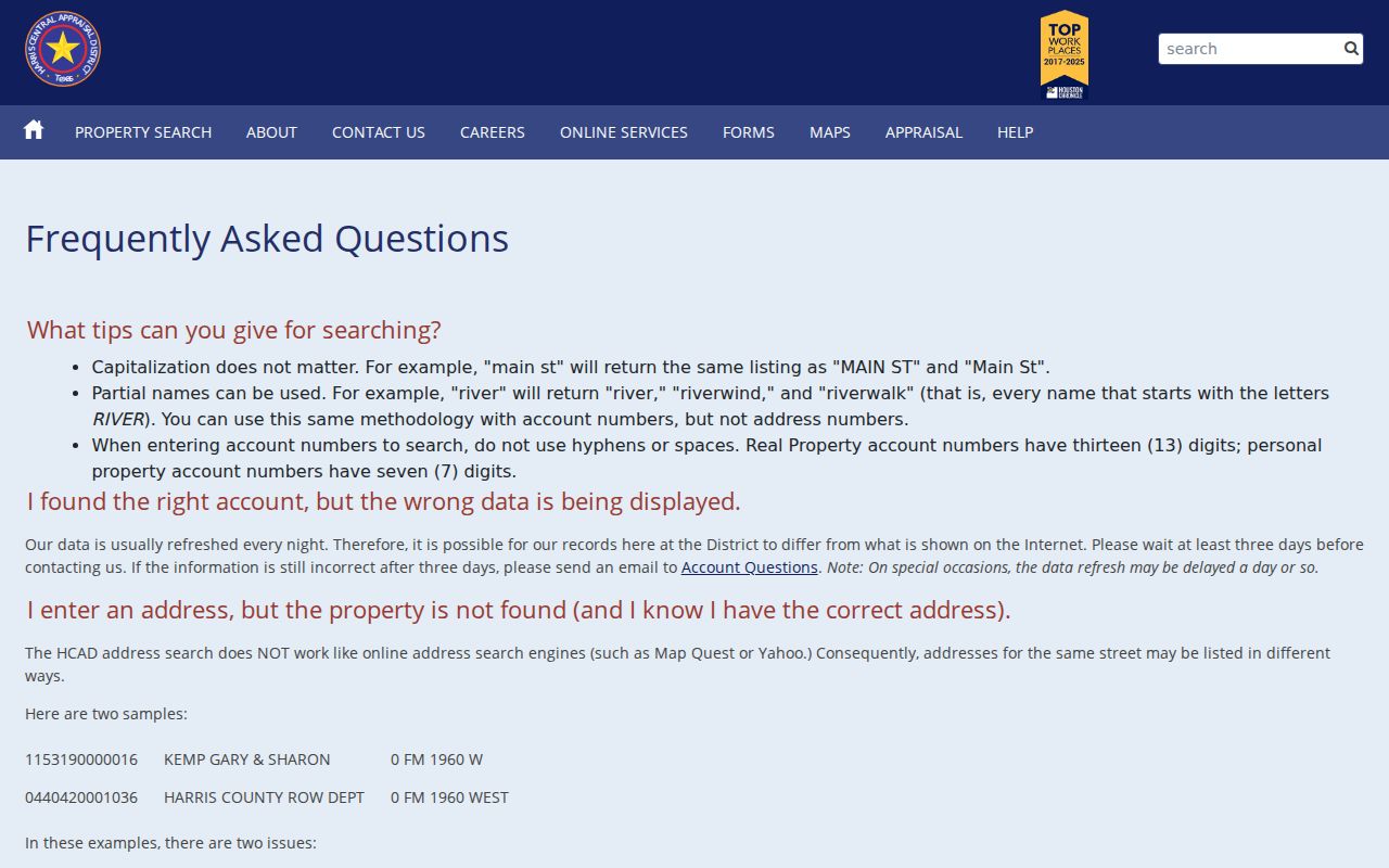
HCAD data usually refreshes nightly. Search a known street in more than one tax year when a returned owner display, situs spelling, exemption, or legal description changes. The appraisal roll is not an abstract or title record, and it does not prove who occupies a parcel.
Pasadena City Limit Checks
A municipal result should be checked separately from the code returned for mail. The Pasadena city district map labels city limits, voting precincts, bayous, the industrial district, districts A through H, and major roads. It does not publish complete postal polygons. Pair it with HCAD parcel and city Engineering information instead of using the postal label as a shortcut.
Pasadena is non-zoned while land-development regulations still apply, and ETJ industrial districts are not subject to city ordinances and permitting. That distinction matters when a permit or map result appears beside a postal address. Record which layer supplied the result: USPS delivery, city limit, HCAD situs, County Clerk legal description, or precinct.
Note: A mismatch is a research lead, not an error by itself, because each record keeper uses a different geographic purpose.
Pasadena Postal Changes
Postal Bulletins show that delivery groupings, names, and boundaries can change. An older USPS distribution source groups 77501, 77502, and 77506 together and 77503 through 77505, 77507, and 77508 together. A 2015 bulletin also contains 77504 to 77505 and 77508 to 77507 entries marked “New.” Those are historical postal leads, not permission to assign a past code to a modern street without checking the bulletin context.
Keep the source date whenever a historic directory, map, or letterhead uses a code. A current Pasadena ZIP code directory should not be projected backward into an older directory edition. Historic records may instead require a street name, legal description, subdivision, lot, block, unit, grantor, or grantee search.
The citywide district and street map was updated August 16, 2022 and identifies city limits, voting precincts, bayous, the industrial district, districts A through H, and corridors such as SH 225, SH 146, Beltway 8, Allen Genoa, Genoa Red Bluff, Red Bluff, and Spencer or Preston or Market. It is a useful dated orientation source when an older address needs context. It does not show complete postal polygons, so retain the USPS result separately.
Pasadena Parcel Identifiers
Several identifiers can describe the same land without being interchangeable. HCAD account numbers identify appraisal records. County Clerk file, film, volume, and page references identify recorded instruments. Subdivision, lot, block, and unit describe the legal parcel, and GIS object IDs identify map features. A metes-and-bounds description can predate a named street, while a parcel can be split, combined, renumbered, or carried with a zero street number.
When the address does not return a useful result, shift to subdivision or legal-description fields in the County Clerk real-property search. Preserve both the modern delivery address and the legal description. This makes a Pasadena postal result usable alongside a property record without treating the two systems as interchangeable.
Pasadena ZIP Code Limits
Neither USPS nor HCAD publishes a general person-by-code roster. The HCAD ZIP filter can return appraisal parcels, and Harris voter search accepts a ZIP with name, county, and date of birth for registration or polling purposes. It is not a household list. Voter web results also exclude telephone, Social Security number, driver license or personal-identification number, date of birth, and protected addresses.
Public utility customer names, a verified school-zone person lookup, and a complete local ZIP-to-neighborhood crosswalk were not located in the research. Do not fill those gaps by inference. Use a dated parcel, city, precinct, and Neighborhood Network comparison when an address crosses systems.
Pasadena ZIP Code Sources
For a current delivery answer, return to USPS with the complete address. For parcel and tax-year details, use HCAD. For city limits, roads, floodplain context, and map questions, use Pasadena Engineering. For legal ownership instruments, use the Harris County Clerk. These routes give a Pasadena ZIP code directory a clear chain of custody rather than one broad claim about a code.
If a portal returns no parcel, try the HCAD address form in local directional style, with N, S, E, or W rather than a spelled-out direction and without periods. The help material also recommends a range search, the zero-address option where appropriate, owner-name variants, and a legal-description or account search when a mailing address differs from the situs. A no-result can reflect mapping timing or an address-format issue rather than a substantive absence.
Practical recordkeeping. Save the full input address, returned postal city and code, source date, HCAD account, and city-limit result together. That preserves the difference between delivery geography and public-record geography.